"The landscape belongs to the person who looks at it..." - Ralph Waldo Emerson
 |
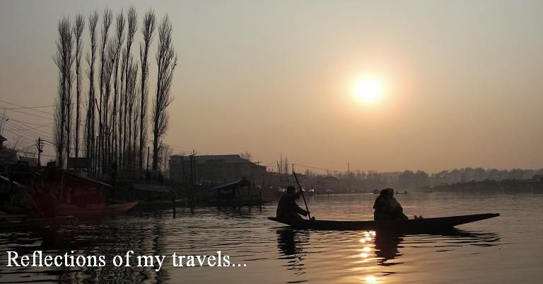
| (The Gilgit River viewed from the suspension bridge) |
Day 06: Monday, 14 September 2015
Route: Gilgit – Hunza – Karimabad
Distance: 101 km
Hotel: Hilltop Hotel
For centuries, Gilgit has been the stopping point on the Silk Route for caravans journeyed south from Kashgar. Chinese monks returning from pilgrimages in India in the 5th century found Buddhism widely practiced in Gilgit. Hinduism came to the area around the 10th century, followed by Islam two hundred years ago.
 |
| (The baazar next to the suspension bridge) |
 |
| (The old bridge is still strong and mighty) |
This morning we had the opportunity to visit and shop at the local Central Asian bazaars selling products from China and local handicrafts. We bought some kurta, Pakistan traditional shirt and Pakol, their traditional cap. It is common for men of every age to wear the pakol in this part of Pakistan. It is worn to shelter from the harsh winter conditions and usually made with woolen material.
 |
| (Pakol, the woolen caps worn by the locals) |
 |
| (A small roundabout in the middle of town) |
We had time to walk on the old suspension bridge located on Gilgit River at the end of the bazaar. This bridge is made of logs and wood planks and wide enough for rickshaws or motorbikes to cross.
We continued our journey on the Karakoram Highway and stopped at Memorial 103, one of the many memorials along the highway built in memory of those gallant men who died on the Karakoram Highway.
 |
| (One of the many memorials along the highway) |
 |
| (A lone cyclist on the Karakoram) |
 |
| (A check point up above the mountains) |
 |
| (Tight security controls along the Karakoram) |
A short distance away we stopped at a check-point in the district of Hunza Nagar where we were again to report on arrival. As we have our travel documents in order, our guides sorted matters with the highway police while the rest of us walked to the Collision Point of Indian and Asian Plates. This is the most unique place on earth and with great geological importance. It is believed that about 55 million years ago, the continental and Indian geological plate drifted and collided with the Asian plate and the collision resulted in the formation of the towering Karakoram, the youngest mountains of the world. The Indian plate is still pushing north into the Eurasian land mass, at about 5 cm a year, causing the mountains to rise about 7 mm annually.
 |
| (A collision point of two continents) |
 |
| (The old and new highways, side by side) |
From this point too we could have a good view of the Old Silk Road up on the cliff side across the river. The old road evolved from a foot path, into pony track and later widened to a jeep road. However, with the construction of the Karakoram Highway in the 70’s, the Old Silk Road fell into disuse. Because of its historical value, the visibility of the Old Silk Road was restored by the Aga Khan Foundation.
 |
| (A good view of the Ancient Silk Road) |
 |
| (The Silk road high up the mountain slopes) |
 |
| (The mountains, valleys and river beds) |
 |
| (A peek out of the coaster for the fresh mountain air) |
As it was time for lunch, we stopped at Rakaposhi Peak View Point at Gulmit Nagar. Lunch was served in the open-air restaurant over-looking Rakaposhi. At an altitude of 1,950 m we could have a superb view of the highest unbroken slope with its gleaming Ghulmet Glacier. Rakaposhi is the 27th highest peak in the world at 7,788 m high and the only mountain on earth that plummets directly, uninterrupted for almost 6,000 m from the summit to its broad base which measures about 20 km east to west.
 |
| (A view of Rakaposhi summit and glacier) |
 |
| (An open-air restaurant with fantastic view) |
 |
| (A bridge over the Gulmet river from the glacier) |
After lunch we continued our journey towards Karimabad, stopping at a few more view points and picking pears and apples along the highway.
 |
| (A rugged terrain cutting across the mountain ranges) |
 |
| (A short break at another view point) |
 |
| (The children of Ganish Village) |
We reached Ganish and performed our prayers at one of the Shiites mosques and madrasah. Ganish Village is the oldest and first settlement on the ancient Silk Road in Hunza located about 100 km from Gilgit. Hunza was an important staging post on the Silk Route and was heavily travelled for thousands of years by traders going back and forth between China and Pakistan. Ganish has famous history, the people of this village used to be warriors or defenders in ancient times.
 |
| (Our 4x4 ride to the view point) |
 |
| (The start of the journey on a treacherous off-road) |
After performing our prayers, there were three 4x4 jeeps waiting to bring us off-roading across the Hunza River to enter the mountain kingdom of Nagar. The drive took about 2 hours each way and we would have ample time to discover this unique village next to the Bualter Glacier and to see the glacier up close.
 |
| (An unpaved road, loose gravels and dusty) |
 |
| (Large boulders and rocks , falling on the track) |
 |
| (No space to pass another vehicle, not even a bike) |
Before we started our ascend we stopped at the confluence of Hunza and Nagar Rivers for photo shots. Here we experienced a slight sand storm that brought us scrambling back into our jeeps to avoid sand getting into our eyes. The Hunza is the only river to slice through the western Karakoram range and has maintained its flow through a cluster of 7,000 m peaks to meet Nagar river also known as Hispar, originating from the Hispar glacier and Chalt river.
As we drove onwards I was both fascinated and alarmed. The road we were driving on was just a dusty pony path along the cliffs and mountain faces. It was a battered piece of tarmac with its edges eaten away by rock falls and erosion, its surface at some stretches no more than dry mud and dust. Furthermore there were no barriers, no matter how flimsy to protect our jeep from a fatal tumble off the steep cliff a few hundred meters or more below. The danger was too real and I had my heart in my mouth throughout the journey.
 |
| (Apple picking at a farm in the valley) |
 |
| (A boutique rest house perch on the mountain slope) |
 |
| (A hot cup of mountain tea and a freshly picked apple) |
But it was a worthwhile once in a life time experience. We had to climb to the view point to sight the glaciers and the snow-capped mountains surrounding the village of Hoper. Hoper offers a fine view of Ultar Peak and Barpu glacier. Hoper Valley is a cluster of villages around a natural bowl at a bend of Bualtar Glacier. This is a base camp for treks into the high, glacier-draped peaks called the Hispar Muztagh. The whole population of this valley speak Burushaski always been a mystery for linguists. This valley is full of natural resources and natural beauty but being ignored and neglected add to its backwardness. A leisurely drive through the tiny picturesque village gave us an opportunity to pick fruits and cannabis from their farms and observe the everyday life of the countryside. The climate of Nagar was pleasant this time of the year and could become very chilly at night.
 |
| (An energetic hike to the steep view point) |
 |
| (A wonderful view of the glacier) |
 |
| (A view of the Lady Finger from our bed room) |
It was already dusk when we descend back using the same treacherous dangerous road. We checked in the Hilltop Hotel in Karimabad and later, were served with hot dinner before we retired for the night.


No comments:
Post a Comment