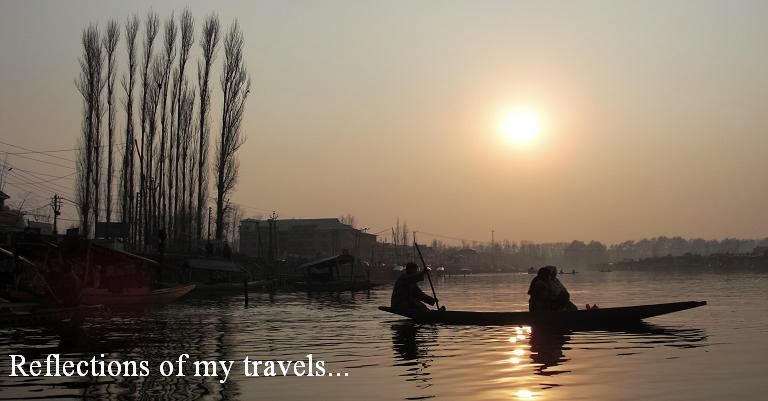
"Never measure the height of a mountain until you have reached the top. Then you will see how low it was..." - Dag Hammarskjold
 |
| (At the China border, the end of Pakistan Karakoram Highway) |
Day 07: Tuesday, 15 September 2015
Route: Karimabad – Sost - Khunjerab Pass
Distance: 240 km
Hotel: Sost PTDC Hotel
After breakfast we checked out and on our way on the Karakoram Highway towards Sost and Khunjerab Pass, the Pakistan/China border.
 |
| (An old sentry point on the rocky mountain) |
 |
| (Rivers and mountain ranges along the Karakoram Hihgway) |
About 2 km from Karimabad we passed Haldeikish Sacred Rocks of Hunza which is located on the left bank of the Hunza River on a hill top. The archaeologists divide the high rock structure of the sacred rock in two portions. The upper portion mainly consist of inscriptions in Kharoshthi, Brahmi, Proto-Sarada, Sarada and Sogdian languages. Mostly the names of the emperors. In the other portion of the sacred rock there were thousands of carvings of ibexes which is testimony for Ibex as being the cultural symbol in this area since Pre-historic era.
 |
| (The strong 20-seater coaster) |
 |
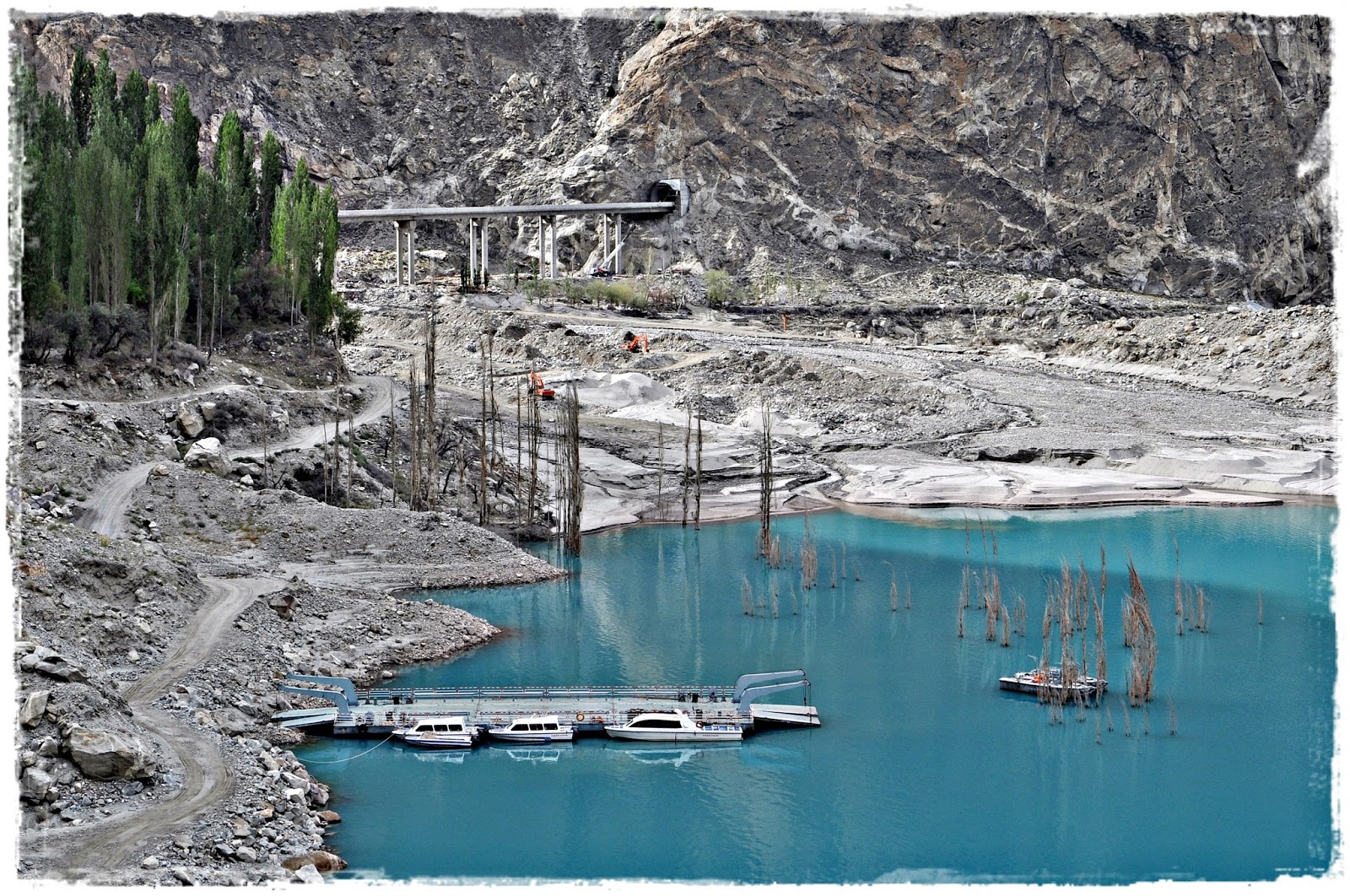
| (A glimpse of the turquoise Atta Abad Lake) |
 |
| (A happy group, full of vibrant colors) |
Another 12 km on the Karakoram Highway we arrived at Atta Abad Lake, also known as Gojal Lake. This artificial lake is in the Gojal Valley created in January 2010 due to a massive dam landslide at Attabad village. The landslide killed twenty people and blocked the flow of the Hunza River for five months. The lake flooding has displaced 6,000 people from upstream villages, stranded from land transportation routes. The lake reached 21 km long and over 100 m in depth by the first week when it began flowing over the landslide dam, completely submerging lower Shishkat and partly flooding Gulmit. The residents also had shortages of food and other items due to the blockage of the Karakoram Highway.
 |
| (The Pakistan-China Friendship Tunnel) |
 |
| (Boats terminal to cross the Atta Abad Lake) |
Next to the Atta Abad Lake is the Pakistan-China Friendship Tunnel, built by the Chinese from 2012 to 2015 for the alignment of the highway at Atta Abad Lake after the massive landslide. Today we were lucky to be among the first to use the tunnel after its inauguration by the Prime Minister Nawaz Sharif yesterday. The tunnel consists of five tunnels with total length of 7 km, two bridges and 78 culverts.
 |
| (The Passu Glacier at the background) |
 |
| (Rock formations from the snow and ice erosion) |
We stopped in Passu, a small village on the Karakoram Highway beside the Hunza River. It lies very near the tongue of the Passu Glacier, and just south of the tongue of the Batura Glacier. The latter is the fifth longest non-polar glacier in the world at 56 km and reaches very near to the highway. After some photo shots and a toilet break at the rest area we continued our journey towards Sost.
We reached Sost early and checked in the PTDC Motel and met with 20 cyclists from the USA who were planning to cross the Pakistan/China border and head to Kashgar.
 |
| (Sost town busy with travelers to and from the border) |
 |
| (Basking in the sun before the journey to Khunjerab Pass) |
Sost is a small town in Gojal, Upper Hunza. It is the last town inside Pakistan on the Karakoram Highway before the Chinese border. The town is an important place on the highway for all passenger and cargo transport because all traffic crossing the Pakistan-China border passes through this town. The Pakistani immigration and customs departments are based here. Pakistan and China have opened border for trade and tourism at Khunjerab. The town is connected by the Karakoram Highway to Karimabad, Gilgit and Chilas on the south and the Chinese cities of Tashkurgan, Upal and Kashgar in the north.
 |
| (The last check point before the border) |
 |
| (A snow tiger in captivity at the sanctuary) |
After a short rest we boarded the coaster and drove towards the border. I feel relieved to have made it this far but a little apprehensive of the high altitude as we will be crossing the Karakoram mountain range to Khunjerab Pass, at an altitude of 4,693 m. In 2013 some from our group experienced altitude sickness and fainted during our trip from Kashgar to Karakul Lake after a long tiring journey on the Karakoram Highway.
 |
| (The majestic Karakoram mountain range) |
 |
| (Black specks of wild yaks along the highway) |
 |
| (A group of grazing yak on the mountain slopes) |
The Karakoram Highway passes the highest concentration of soaring peaks and glaciers in the world, five of which are over 8,000 m. On the way we stopped at a check-point and Community Conservation Area where we had the opportunity to sight and took a close-up photo shot of a snow leopard and an Ibex. Wild yaks could be seen along with mountain goats on the route to Khunjerab Pass.
 |
| (A busy transit point for travelers before crossing the border) |
 |
| (Mesmerizing mountains, viewed from the highway) |
The Khunjerab Pass is the highest paved international border crossing in the world and the highest point on the Karakoram Highway. The roadway across the pass was completed in 1982, and has superseded the unpaved Mintaka and Kilik Passes as the primary passage across the Karakoram Range. On the Pakistani side, the pass is 75 km from Sost. On the Chinese side, the pass is the southwest terminus of China National Highway 314 and is 130 km from Tashkurgan and 420 km from Kashgar. The Chinese port of entry is located 3.5 km along the road from the pass in Tashkurgan County.
 |
| (The iconic border archway between Pakistan and China) |
 |
| (Not that far to Kashgar, China) |
The long, relatively flat pass is often snow-covered during the winter season and as a consequence is generally closed from November to May. This is one of the international borders where left-hand traffic in Pakistan changes to right-hand traffic in China and vice-versa
We had our packed lunch at the border while watching the border-crossing activities from a distance. After some photo shots and playing with snow we drove back to Sost. The evening was spent walking from one end of town to the other end with nothing much to see.
 |
| (The town is quiet in the evening) |
 |
| (A captivating view from our motel room) |
We headed to bed early after dinner, worn out from our journey and the excitement of the trip so far.


No comments:
Post a Comment